
SIIS
- #High Resolution Satellite Video
- #Satellite Video Usage
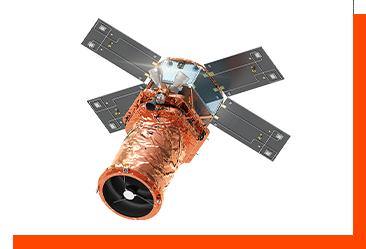
- #SpaceEye-T

SIIS were born out of the will to make a better world through satellite imagery. It is a subsidiary of Satrec Initiative Co., Ltd., the only company that exports satellite systems in Korea. Currently, we are in charge of the global commercial supply of KOMPSAT data developed by KARI (Korea Aerospace Research Institute). In August 2024, our brand-new satellite SpaceEye-T will be launched. SpaceEye-T will provide the highest resolution of 30cm to meet the diverse needs of our customers. Our efforts to discover new values in the space will continue.
- +82-42-341-0055
- National Satellite Usage Center, 169-84, Gwahak-ro, Yuseong-gu, Daejeon, Republic of Korea
- www.si-imaging.com
Product Overview and Main Content
High Resolution Satellite Imagery
- Optical: KOMPSAT 3 and 3A
- Radar: KOMPSAT 5
- Methane Detection: GHGSat
- Hyperspectral: Pixxel
- Infrared Sensor: SatVu
- Small Radar Cluster: Umbra
- RF Detection: HawkEye360
DRS (Direct Receiving System)
- Direct Receiving System: Direct reception on site with RF
- VDRS(Virture DRS): Date reception in KARI, delivery of raw data vis FTP to customer
- Direct Product System: Data reception and product generation in KARI, delivery of image product via FTP
Value Added Services
- HD vector map: Using AI technology to convert data into maps through Ecopia
- Mosaic product: Combining a number of satellite images into a single imagery through Indyware
AI Training Data Pack
- For only AI Training purpose.
- 50 Scenes + Patches for 50 Scenes
Product Highlights
- High resolution satellite imagery is being used in various industries worldwide for national security, mapping, infrastructure and energy monitoring, agriculture, forestry management, and disaster response. In particular, in fields where periodic checks of wide area is needed. And DRS (Direct Receiving System) is a program that installs a system to directly receive KOMPSAT data in the area where the customer is located. It is a modular system differentiated according to the process of fast acquisition, storage, processing, analysis, and distribution of satellite imagery data. It is provided as one of DRS, VDRS, or DPS format according to customer requirements.
Areas of Application
-

With the recent development of AI technology, satellite images are being used to collect and analyze a wide range of information. In the era of digital transformation, satellite images are playing a major role in providing new spatial information along with artificial intelligence and 3D technology. Combining 3D, AI technology, and satellite imagery can make Earth and cities real. It can also be used to prepare rapid countermeasures against climate disasters, such as monitoring disaster sites to cope with climate change or managing heat island phenomena in cities and managing heat-prone areas. It is a field that requires a variety of technical and intelligent approaches and developments using data-based satellite images for a safer and more sustainable Earth.
Possible Areas for Cooperation
| Technology license | ||
| Investment Attraction | ● | |
| Joint venture | ||
| Technical Cooperation | Product Joint Development | ● |
| (New Product) Performance Test | ||
| Applying Other Products’ Technologies | ● | |
| Production Consignment | New Material Production | |
| Production Line Operation | ||
| Changing Customers (CMO) | ||
| Installing New Process | ||
| Commercialization Contract Accompanying Technical Support | Assembly | |
| Designing Commercial Products (Design & Engineering) | ||
| Technical Consulting (Technical Advice, Education and Training) | ● | |
| Quality Maintenance | ||
| Operations Maintenance | ||
Business Results
Market Outlook
- According to a report by Euroconsult (2021), the satellite usage market is expected to record an annual growth rate of 4%, from a value of USD 1.6 billion in 2020 to USD 2.5 billion in 2030. The defense industry makes a up a total of approximately 70% of the total market for satellite video applications. In particular, ultra-high resolution satellite video of 50cm or less is expected to have an annual growth rate of 12% over 10 years. New technologies like AI and new systems are also being introduced, and in a variety of industries demand for satellite imaging data is growing quickly beginning with the commercialization of space through small and micro satellites, and the satellite video service industry is expected to grow exponentially.

Commercialization Plans
-
- SIIS works with approximately 160 foreign partners to supply the Korea Aerospace Research Institute’s KOMPSAT satellite video abroad, and supplies foreign satellite video and data with special characteristics domestically. In addition, it is preparing for the launch of the 30cm resolution optical satellite SpaceEye-T with its parent company, Satrec Initiative Co., Ltd., and it plans to contribute to the domestic space industry and respond to a variety of demands by supplying this range of earth observation data.